A spell of dust storms, thunderstorms and scattered rain is expected across parts of India. The change could lower temperatures in rain-hit areas, though some states may continue to face heatwave conditions.
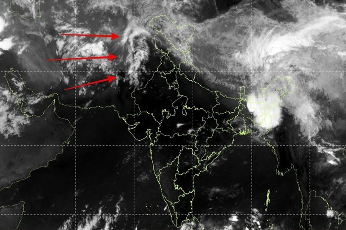
Meteorologists say a combination of summer storms and successive Western Disturbance systems will begin influencing large parts of India early next week, triggering dust storms, thunderstorms, and scattered rainfall.
Weather experts explain that heatwaves often act as a precursor to these storm systems. As temperatures soar, they create conditions that allow moisture-laden winds from the Arabian Sea and Bay of Bengal to move inland.
When combined with Western Disturbances and local wind patterns, this leads to the formation of inland cyclonic circulations, fueling powerful evening storms that typically travel from west to east.
WHEN WILL RAIN OR STORMS HIT?
The first signs of this transition are expected on April 27, with isolated dust storms and thunderstorms likely across parts of Rajasthan, Haryana, and Delhi-NCR, covering roughly 30-50% of the region.
The activity is forecast to intensify between April 28 and April 30, when a wider swathe of the country, including Punjab, Uttar Pradesh, Bihar, Jharkhand, Odisha, Chhattisgarh, Karnataka, Telangana, and Kerala, could witness storm activity with 50-75% coverage.
These storms are expected to be brief but intense. Strong gusty winds ranging between 40 and 80 km/h may kick up dust storms, followed by short spells of moderate to heavy rain lasting 15 to 45 minutes. In some cases, light drizzle could persist for a few hours after the main storm passes.
Thunderstorms will likely be accompanied by lightning and rumbling thunder, though the risk of hailstorms remains relatively low.
Most of the activity is expected during the late afternoon to evening hours, typically between 2 PM and 10 PM. Some systems may extend into the night or early morning, but with reduced coverage.
WILL HEAT GO DOWN?
The impact on temperatures could be significant. While heatwave conditions are expected to persist through Monday, a gradual drop in temperatures is likely from Tuesday evening onward in rain-affected areas. Maximum temperatures, currently hovering between 42°C and 46°C, may fall to a range of 36°C to 41°C by midweek.
However, experts caution that this does not signal the end of summer. While the heatwave may ease, humidity levels could rise slightly due to changing wind patterns, making afternoons still feel warm. Evenings and nights, especially in areas receiving rainfall, are expected to become more comfortable.
There are also safety concerns associated with these storms. Strong winds, occasionally reaching up to 100 km/h in isolated cases, could cause disruptions. Residents are advised to stay indoors during storm activity, particularly if dark clouds approach and thunder is heard.
Not all regions will benefit equally. Large parts of Gujarat, Madhya Pradesh, and Maharashtra are expected to continue experiencing heatwave conditions with limited rainfall.
Meteorologists advise citizens to track local weather updates closely, as the timing and intensity of these storms may vary. With dynamic systems at play, staying prepared could make all the difference as India transitions from extreme heat to stormy skies.
Article source: indiatoday.in