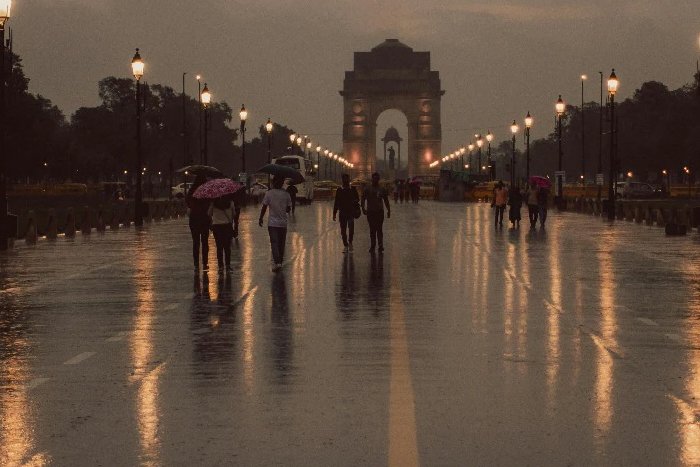
Large parts of India are witnessing a sharp drop in temperatures after weeks of severe heatwave conditions, as widespread thunderstorms, rain and strong winds signal the arrival of an active pre-monsoon phase even as the India Meteorological Department (IMD) has forecast a below-normal southwest monsoon this year.
Delhi recorded its lowest maximum temperature in three weeks after rain and gusty winds swept through the city on Friday. The city’s maximum temperature settled at 36.8 degrees Celsius, the lowest since May 8 when it stood at 36.4 degrees Celsius.
The India Meteorological Department (IMD) has forecast thunderstorms and rainfall across large parts of north, east and central India over the next few days.
Temperatures dip as heatwave grip weakens
According to the IMD, maximum temperatures over northwest India are expected to remain significantly below the levels recorded during the recent heatwave spell.
The weather office has forecast a fall of 5-7 degrees Celsius in maximum temperatures across northwest India, while central India is likely to witness a decline of 3-5 degrees Celsius over the coming days. Gujarat is also expected to see a gradual cooling trend.
The development marks a significant shift from conditions seen earlier this week when temperatures crossed 45 degrees Celsius in several locations across north and central India.
However, heatwave conditions may continue to persist over parts of Telangana, Madhya Pradesh, Chhattisgarh, Vidarbha and west Rajasthan.
Thunderstorms, strong winds to continue across many states
The IMD has forecast widespread thunderstorm activity accompanied by lightning and gusty winds over large parts of the country.
Northwest India, including Punjab, Haryana, Delhi, Uttar Pradesh and Rajasthan, is expected to continue witnessing thunderstorms, squally winds, dust-storms and isolated hailstorm activity.
In eastern India, Bihar, Jharkhand, Odisha and West Bengal are also set to witness thunderstorms, with heavy rainfall likely in several areas.
The northeast is expected to remain under a prolonged wet spell, with heavy rainfall forecast over Arunachal Pradesh, Assam, Meghalaya and the other northeastern states.
Across south India, rainfall activity is expected to remain active over Kerala, Tamil Nadu, Karnataka, Telangana and Andhra Pradesh, with isolated heavy rainfall likely in several districts.
Delhi records sharp temperature drop
The Met Department has forecast generally cloudy conditions accompanied by light rain, thunderstorms and gusty winds on Saturday and Sunday.
The maximum temperature in the national capital is set to hover within the range of 34-37 degrees Celsius, while the minimum temperature is expected to remain between 22 and 26 degrees Celsius over the next two days.
Similar conditions are expected across the wider Delhi-NCR region, including Noida, Gurugram, Ghaziabad and Faridabad.
Cloudy skies and light rainfall on Friday helped bring down temperatures sharply across the city as several stations recorded declines of 7-9 degrees Celsius over the past two days.
According to the IMD, the city recorded light rain, thunderstorms and wind speeds reaching 61 kmph, with maximum temperatures remaining markedly below normal.
IMD forecast on monsoon
Even as pre-monsoon activity provides relief from extreme heat, the IMD’s latest forecast points to a weaker-than-normal monsoon.
The weather office expects the country to receive rainfall equivalent to 90 per cent of the long-period average during the southwest monsoon season, with El Niño conditions likely to suppress rainfall over large parts of India.
Article source: business-standard.com